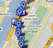
 This project mashes up status updates to the Twitter short messaging service with data from a GPS device to plot the location of individual Tweets on Google Maps or in Google Earth.
Twitter does include some location services, but they seem to be limited to setting the user’s current location rather than the location of each message. Also, a cursory look through Twitter’s API only revealed a granularity in location at the city level.
A custom written Java program tries to match up messages and location using common time stamps, choosing the nearest match as necessary. The resulting data is exported as a KML (Keyhole Markup Language) file which can be viewed in Google Earth or plotted online using Google Maps. This is currently an off-line process, but it would be interesting to utilize the built-in GPS units of modern mobile devices to provide a real-time, on-line service for users to plot and view their location as they use Twitter.
The prototype is called M5 Bus : Tweeted, which depicts a trip up the west side of Manhattan on the M5 bus as an assignment for NYU’s Interactive Telecommunications Program.
Leave a Reply
You must be logged in to post a comment.